



投稿日:2023年07月07日
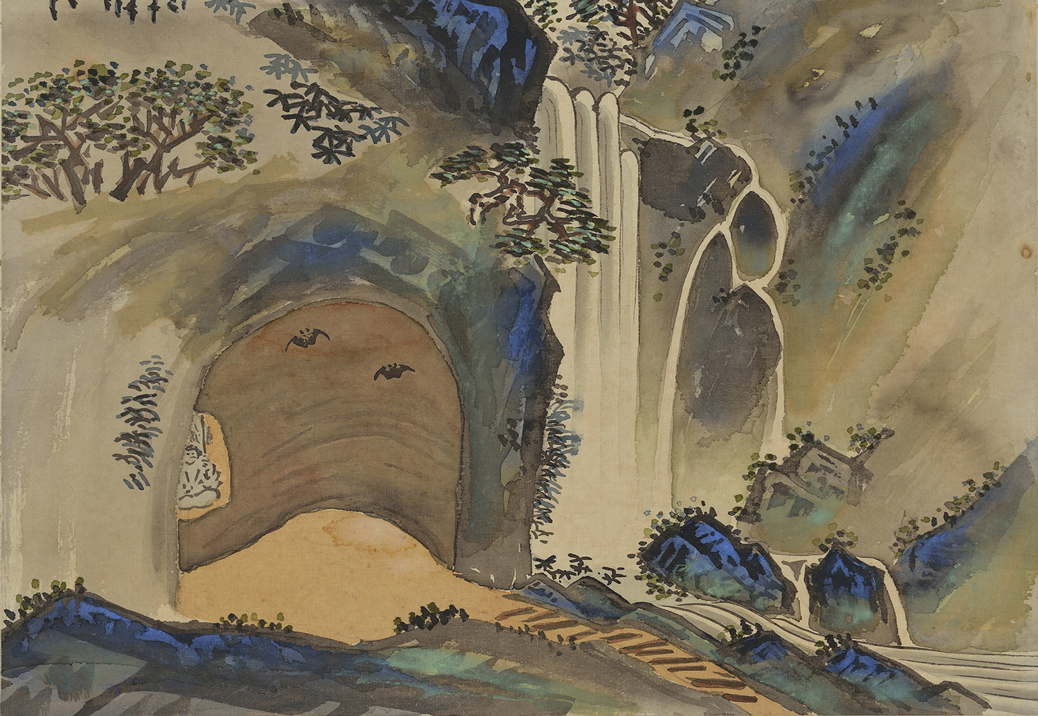
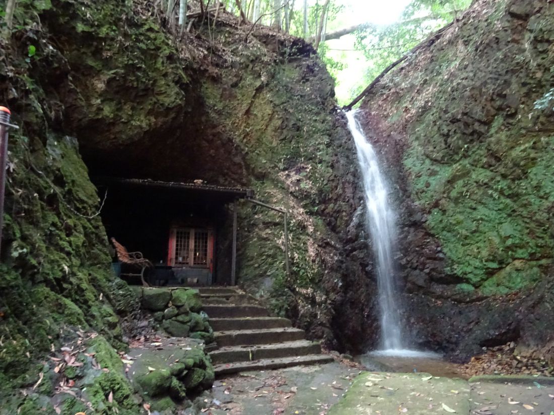
There is a waterfall in the Machida area of Tsuwano known as Narutaki Falls. The water drops approximately 16 metres and is exceptionally clean. Residents of nearby areas, including Takinomae, Machida, Nakachō, and Yokobori, use it as drinking water.
Long ago, the site was home to Monju-dō Hall and a Shugendō temple called Jōju-in. By 1913, when Satoharu drew this scene, only Kotohira Shrine remained. The waterfall was also known as Niodo Falls. Caves near the falls are home to a large colony of bats.
How to get there:
Narutaki Falls is located a short distance from Tsuwano’s old town, near the MORI Ōgai Museum. It is about a 20-minute walk from the old town, or around 35 minutes from Tsuwano Station. Walking is a pleasant option, though we also recommend renting a bicycle.
The GPS position of the waterfall is
34.458581, 131.772257 (or 34°27’30.9″N 131°46’20.1″E).
Google Maps Location
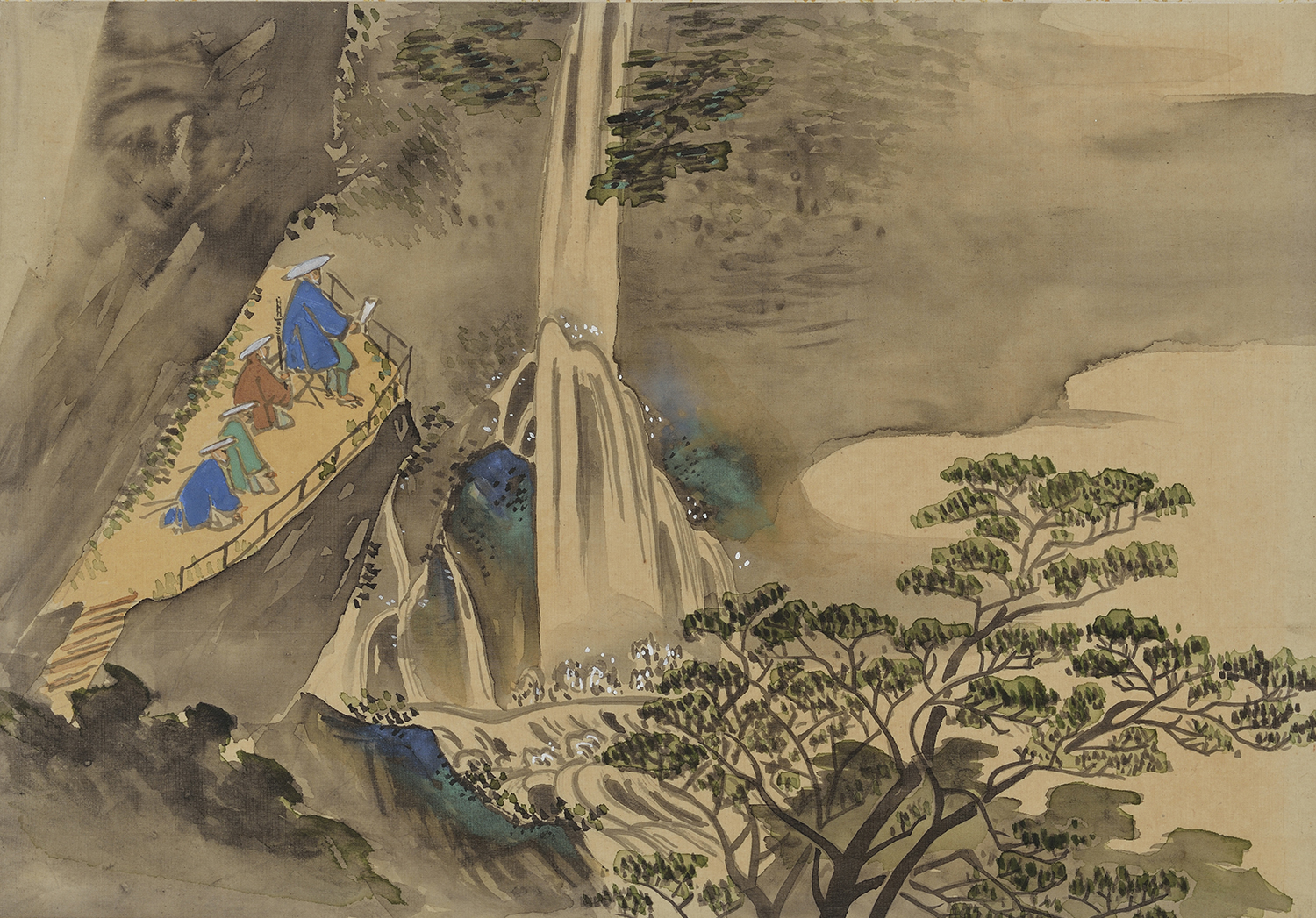
Shiraito (White Thread) Falls is located in the Takatamura area (now known as the Takamine area) of Tsuwano. When the water level is high, the water cascades over the projecting rocks into the basin below, resembling strands of unravelled white thread. This is said to be the origin of the waterfall’s name.
According to local tradition, when the poet Izumi Shikibu gave birth to her daughter Koshikibu in nearby Shigoyabu, she used water from these falls for her baby’s first bath.
The domain lord is believed to have visited the falls from time to time to enjoy their coolness. On the left side of the illustration, a group of samurai can be seen viewing the waterfall. The figure seated on the folding stool is thought to be the domain lord. This is one of the few drawings in the Tsuwano Hyakkeizu to depict the domain lord himself.
When you visit Shiraito Falls today, you can imagine following in the footsteps of the lords of the past.

How to get there:
Shiraito Falls is located in Tsuwano, near the Washibara Hachimangū Horse Archery Grounds. It is about a 40–45-minute walk from Tsuwano Station. For a more comfortable visit, we recommend taking a taxi or renting a bicycle. The falls can be difficult to find, so visiting with a guide is recommended.
The GPS position of the waterfall is
34.4538175, 131.7415242 (or 34°27’13.7″N 131°44’29.5″E)
Google Maps Location
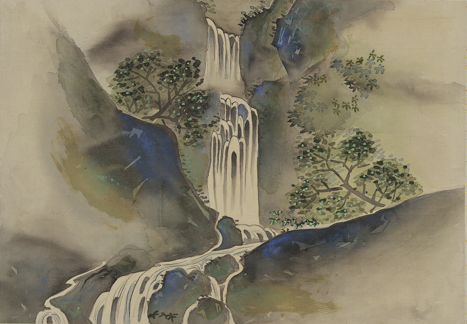
On the route from the castle town of Tsuwano to the Nichihara district lies an area known as Otada. In these mountains, a narrow valley and stream form two waterfalls: Ontaki Falls and Mentaki Falls.
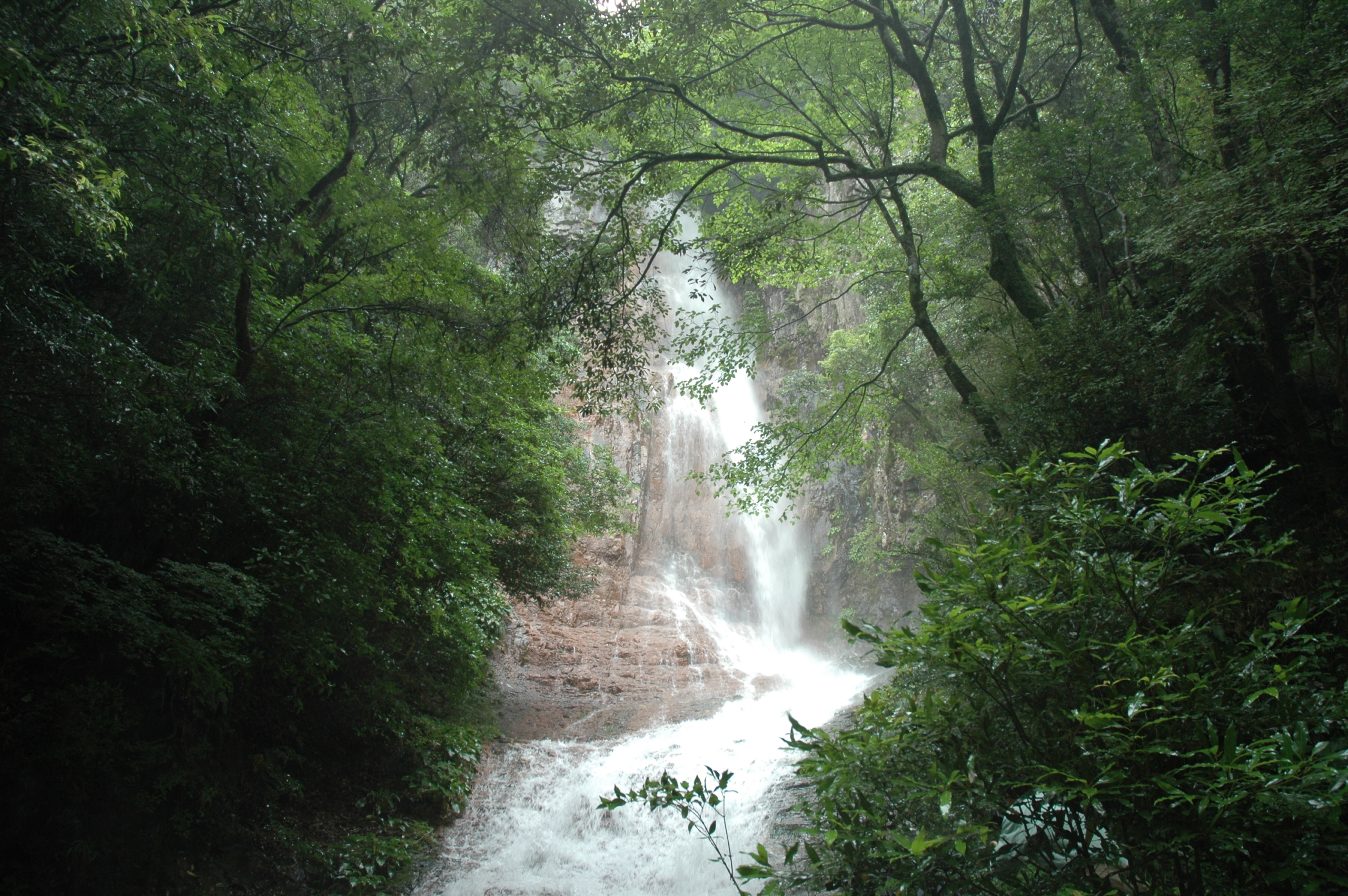
In the Tsuwano Hyakkeizu, the waterfall on the near side of the footpath is Ontaki Falls. Looking up at the water as it plunges from above, it seems almost close enough to catch. Flowing over reddish rocks like strands of white thread, the waterfall creates a striking and beautiful scene.
How to get there:
Ontaki Falls is located outside the town centre, towards Masuda, near the Nichihara area of Tsuwano. It is accessible only by car or taxi, and the road leading to the trailhead can be difficult to find. The journey from Tsuwano takes about 25 minutes by car, followed by a 10-minute walk to the falls.
The approximate GPS position of the waterfall is
34.514258, 131.841778 (or 34°30’51.3″N 131°50’30.4″E)
Google Maps Location
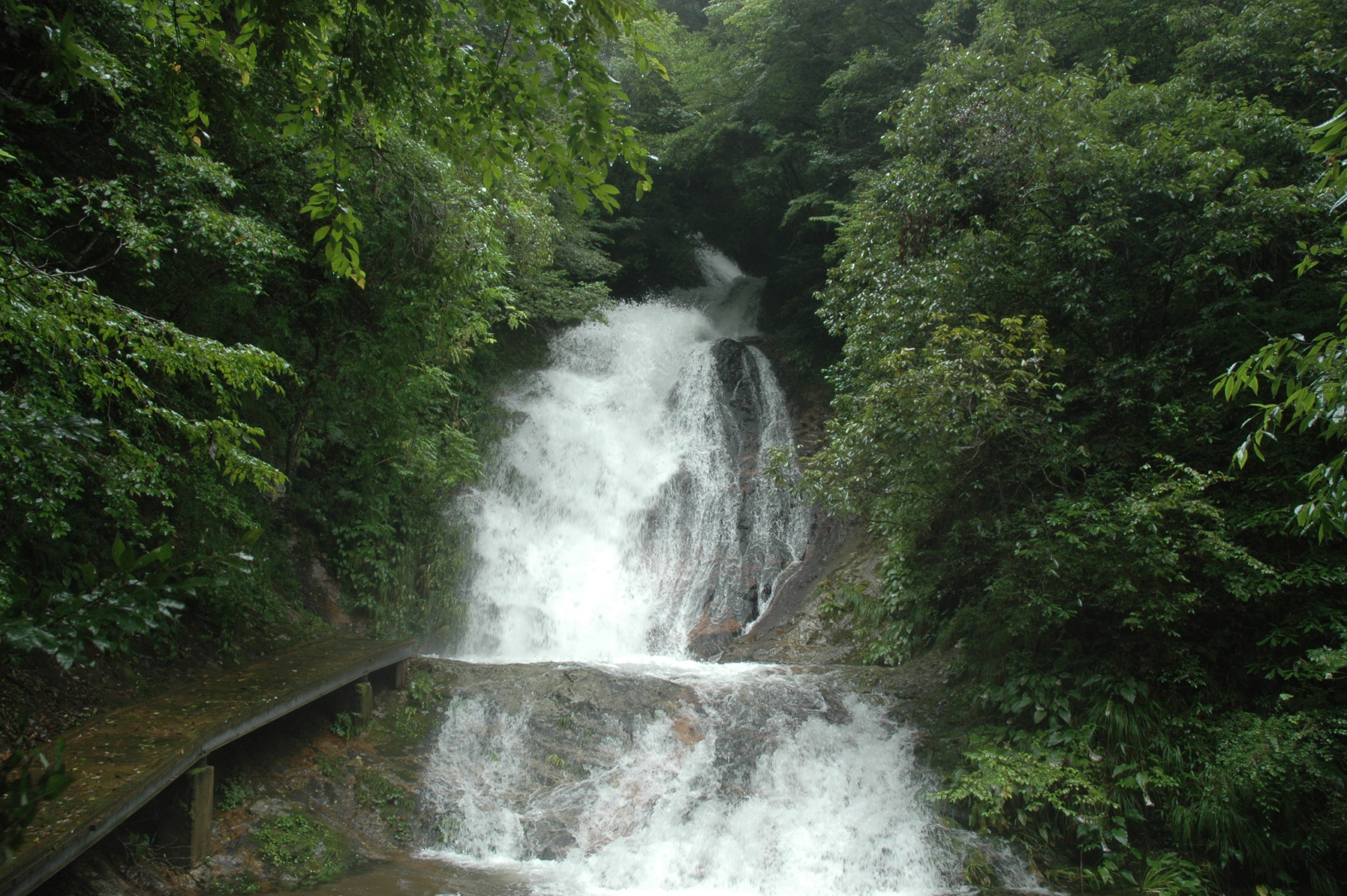
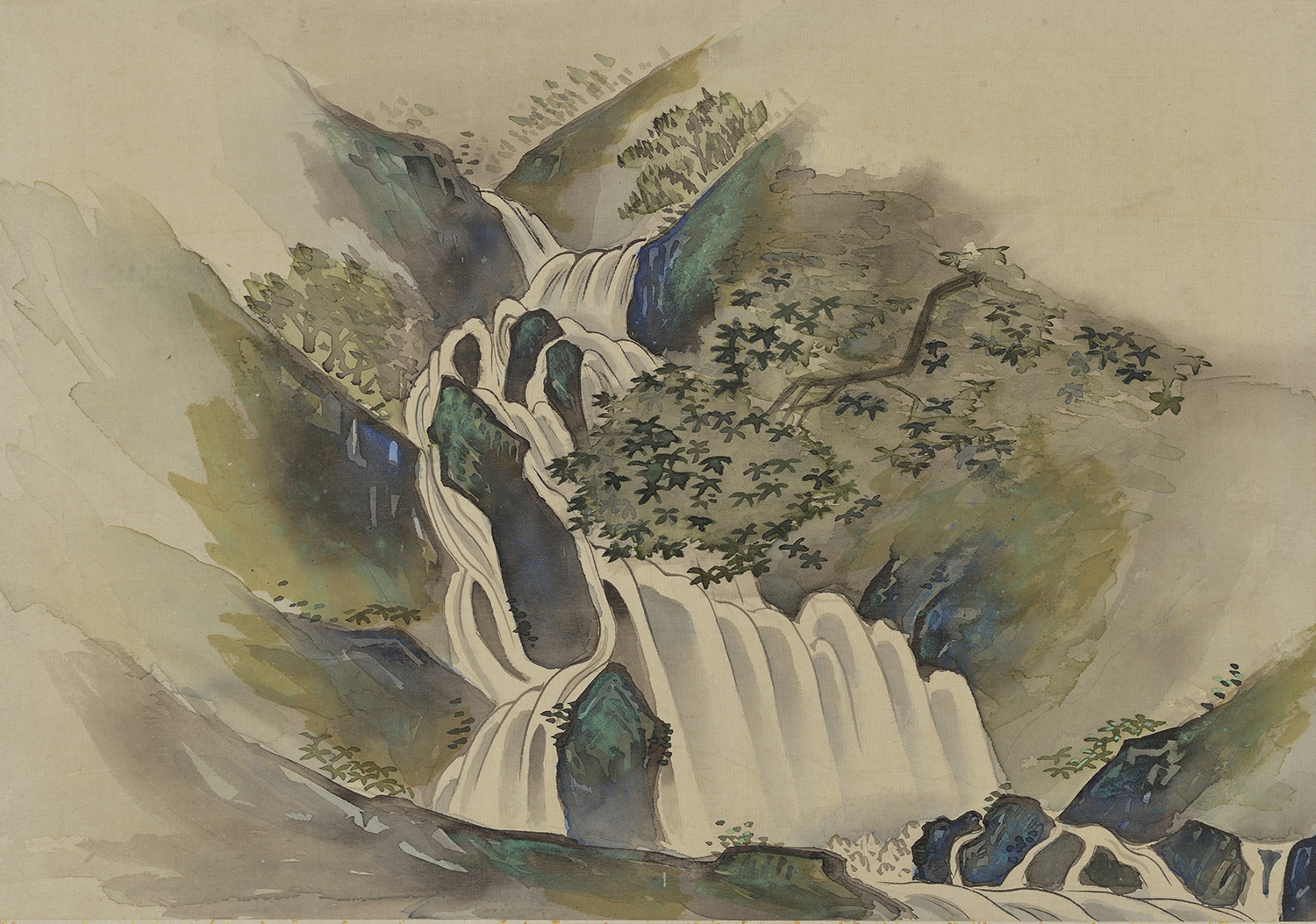
On the far side of the footpath is Mentaki Falls. Satoharu wrote that it was a place Lord Oki-no-kami Koremi often visited for recreation. The water of Mentaki Falls flows down a sloping rock face, allowing visitors to view it from close range. Its thick, white cascade is particularly impressive. It is rare to find two waterfalls with such contrasting appearances so close together.
Including this scene, four views in the Tsuwano Hyakkeizu depict waterfalls, suggesting how much the domain lord appreciated them.
How to get there:
Mentaki Falls is located outside the town centre, towards Masuda, near the Nichihara area of Tsuwano. It is accessible only by car or taxi, and the road leading to the stream can be difficult to find. The journey from Tsuwano takes about 25 minutes by car to the parking area, followed by a 10-minute walk to the waterfall.
The approximate GPS position of the waterfall is 34.5126471,131.8411321 (or 34°30’45.5″N 131°50’28.1″E)
Google Maps Location